

LiDAR (Light Detection and Ranging) has become one of the most powerful technologies in modern surveying and mapping. By using laser pulses to measure distances with extreme precision, LiDAR enables surveyors, engineers and planners to capture highly detailed, three-dimensional representations of the physical world—faster and more accurately than many traditional methods.
In Australia, LiDAR is now widely used across civil construction, infrastructure planning, mining, environmental management and urban development. Providers of specialist LiDAR Solutions support projects where accuracy, efficiency and reliable data are critical, particularly across large or complex sites.
Here’s how LiDAR works, how it’s applied in surveying and mapping, and why it has become such an essential tool across so many industries.
What is LiDAR and How Does It Work?
LiDAR is a remote sensing technology that measures distances by emitting rapid laser pulses and recording how long they take to reflect back from surfaces. Because the speed of light is constant, these time measurements can be converted into extremely accurate distance calculations.
A LiDAR system typically consists of:
- A laser scanner
- A GPS receiver
- An inertial measurement unit (IMU)
Together, these components allow millions of individual measurements to be collected every second, each with precise positional data.The result is a dense “point cloud”—a collection of data points that accurately represent the shape, elevation and features of the surveyed environment.

Key Applications of LiDAR in Surveying
- Topographic Surveys
One of the most common uses of LiDAR in surveying is the creation of detailed topographic maps. LiDAR can rapidly capture elevation data across vast areas, making it ideal for:
- Road and rail corridor surveys
- Subdivision and land development planning
- Flood modelling and drainage analysis
Unlike traditional ground-based methods, LiDAR can survey challenging terrain with minimal site disruption, significantly reducing field time.
- Infrastructure and Construction Mapping
LiDAR plays a vital role throughout the lifecycle of infrastructure projects. Surveyors use LiDAR data to:
- Create accurate base maps for design
- Validate earthworks volumes
- Monitor construction progress
- Identify clashes between existing and proposed assets
The high accuracy of LiDAR allows engineers and contractors to make informed decisions early, reducing costly rework later in the project.
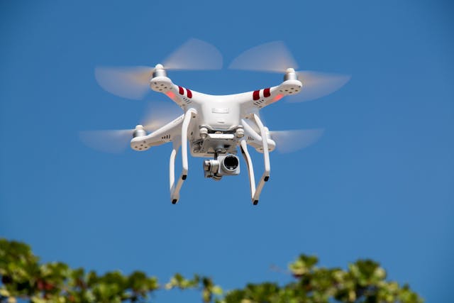
- Aerial LiDAR for Large-Scale Mapping
Mounted on aircraft or drones, aerial LiDAR is used to map large or remote areas efficiently.This approach is especially valuable for:
- Regional planning
- Mining and quarry surveys
- Forestry and vegetation analysis
- Coastal and riverine studies
Aerial LiDAR can penetrate vegetation gaps, allowing surveyors to capture ground elevations even in heavily forested areas—something traditional photogrammetry often struggles to achieve.
LiDAR in Environmental and Land Management
LiDAR is increasingly used in environmental surveying due to its ability to capture fine detail without disturbing sensitive landscapes. Common applications include:
- Floodplain and catchment modelling
- Erosion and landslip analysis
- Wetland and coastal monitoring
- Habitat mapping and conservation planning
Because LiDAR data can be revisited and re-analysed over time, it is particularly useful for tracking environmental change and supporting long-term land management strategies.
From Point Clouds to Practical Mapping Outputs
Raw LiDAR data is only the beginning. Once captured, the point cloud is processed using specialised software to produce practical deliverables such as:
- Digital Terrain Models (DTMs)
- Digital Surface Models (DSMs)
- Contour maps
- 3D models and visualisations
These outputs integrate seamlessly with CAD, GIS and BIM platforms, making LiDAR data highly versatile for surveyors, designers and planners alike.
Why LiDAR is Transforming Modern Surveying
The growing adoption of LiDAR in surveying and mapping is driven by several key advantages:
- Speed: Large areas can be surveyed in a fraction of the time.
- Accuracy: Millimetre-level precision is achievable.
- Safety: Reduced need for surveyors to access hazardous terrain.
- Data richness: Millions of data points provide unparalleled detail.
For projects where precision, efficiency and reliable insights matter, LiDAR has become an indispensable tool rather than a niche technology.
The Future of LiDAR in Surveying and Mapping
As LiDAR sensors become more compact and cost-effective, their use will continue to expand. Integration with drones, autonomous vehicles and advanced data analytics will further enhance how surveyors capture and interpret spatial data.
For Australia’s surveying and mapping industry, LiDAR is no longer just an emerging technology—it’s a foundational tool shaping how projects are planned, designed and delivered well into the future.


Leave a comment